Project Category: Geomatics
Join our presentation
Zoom Passcode: 081384
About our project
The COVID-19 pandemic has dramatically impacted how people currently live and work. Indoor areas in particular, such as schools, offices, and local businesses, have often had trouble finding a balance between keeping its customers and employees safe while also staying open for business. Although the use of countermeasures such as face masks and physical can help alleviate some of these risks, spaces like these need ways to quickly measure and quantify the risks posed by COVID-19 in a manner that is predictable, safe, and needs little end user involvement to help business owners and workplaces make more informed decisions about the risks on an individual, per-room basis.
Thus, COVID Monitor, the COVID-19 Workplaces and Workforces Safety Solution, was created.
The Safety Solution uses a combination of Computer Vision sensors and Geographic Information Systems (GIS) to create an online map of an indoor space via its floorplan, and uses a simplified statistical math model derived from real-world COVID-19 research to calculate the approximate risk of contracting COVID-19 in a given room using the room’s size, whether or not people were wearing a face mask as they entered the room, and the time at which they entered the room.
Details about our design
HOW OUR DESIGN ADDRESSES PRACTICAL ISSUES
The design of our product addresses the practical issue that many local businesses and workplaces face in the pandemic era, wherein they need to strike a balance between keeping their own employees and customers safe while they conduct business inside the premises, while also minimizing the occurrence of new COVID-19 cases in that indoor space in order to stay open and reduce downtime.
Many businesses have adapted to the new reality of COVID-19 by implementing countermeasures such as physical distancing, barriers, face masks, and an overall shift into remote or online business wherever possible. However, many business owners and workplace employees don’t have a way to quantify the effectiveness of any of these countermeasures until the worst-case scenario of a positive COVID case is discovered on-premises. By using the COVID-19 Safety Solution, businesses can have a way to monitor the risks of COVID inside each room of their building, and make informed decisions on their safety as a whole.
WHAT MAKES OUR DESIGN INNOVATIVE
Our team’s design is innovative due to the utilization of both computer vision technologies and a predictive statistical model to create a novel approach to mitigating the risks of COVID-19.
Computer Vision:
The end product uses a computer-vision system that is comprised of an NVIDIA Jetson Nano development kit connected to a Raspberry Pi V2 Camera Module for detecting human faces as they enter a room, with or without their masks on. Under the hood, the system is running TinyYOLO, an implementation of the open-source You Only Look Once (YOLO) real-time object detection system, to detect faces from either the camera module or a pre-recorded video and send the output to the web server.
COVID-19 Math Model:
The COVID-19 math model used by the project is a reverse-engineered implementation of a math model created by Prof. Jose-Luis Jimenez at the University of Colorado in Boulder in August 2020, where it was featured in a National Geographic article. This model uses the percentage of infected population, mask efficiency, indoor room space, and other variables to determine the approximate risk of COVID-19 infection in that room given a certain period of time, and was adapted by the project team to work with the computer vision technology used by the project.
Web Server and UI:
The web server for the project was created using Node.JS and MongoDB, and hosted on Heroku, contains the files math model itself, as well as the UI that contains the maps and floorplans for buildings uploaded to it. Built on the React framework and Elastic UI, the site’s mapping features use the Leaflet mapping library to render building floor plans and overlay room polygons using the GeoJSON file format.
WHAT MAKES OUR DESIGN SOLUTION EFFECTIVE
When used in combination with existing COVID-19 mitigation techniques such as contact tracing and physical distancing, the solution works to business owners and workplace employees by better informing them about the risks of COVID-19 on an room-by-room basis, rather than the building as a whole.
- Passive: The solution relies on computer vision rather than voluntary sign-ups via contact tracing apps or services, it is completely passive, allowing customers and employees to continue going about their daily routine with minimal disruption.
- Scalable: The solution was designed from the beginning to accept the input from multiple computer vision sensors, meaning that it can be scaled up to cover entire floors of an indoor space.
- Privacy-Focused: The solution does not store or contain any identifiable user information, as the computer vision algorithm is solely used for mask detection.
HOW WE VALIDATED OUR DESIGN SOLUTION
Our design was validated by testing the computational performance of both the computer vision sensors as well as the math model, and evaluating the UI by testing out common workflows that users would typically do on the site (i.e. finding a building, getting room data, adding a room) and evaluating their usability and functionality.
The computer vision system was found to have generally good accuracy when it came to detecting if masks were being worn, and was able to detect at every 3rd frame at approximately 10-12 frames per second.
Although the math model couldn’t be tested in the real world due to restrictions on in-person testing, especially for something as risky as COVID-19, the implemented math model was tested against the reference original math model by using identical test datasets and verifying that they produce the same or similar outputs given the simplifications needed to make the model work on the site.
FEASIBILITY OF OUR DESIGN SOLUTION
The project, as currently shown here, serves as a proof of concept for a potential larger-scale sensor deployment in the future, and as such, still has some features (i.e. the removal of polygons and room data) that are only workable by those with developer access.
Although the project team would ideally like the pandemic to end before the implementation of this solution is necessary, the project was designed from the start with the ability to scale up to use multiple computer vision sensors in order to track the COVID-19 risk for multiple rooms, as well as use as much open-source software in order to allow end users to make their own modifications to the service
Partners and mentors
Our team would like to thank the project supervisor, Dr. Steve Liang, for his assistance in guiding the project from the very beginning, as well as to our friends and family that have supported us through every step of the process.
Our photo gallery
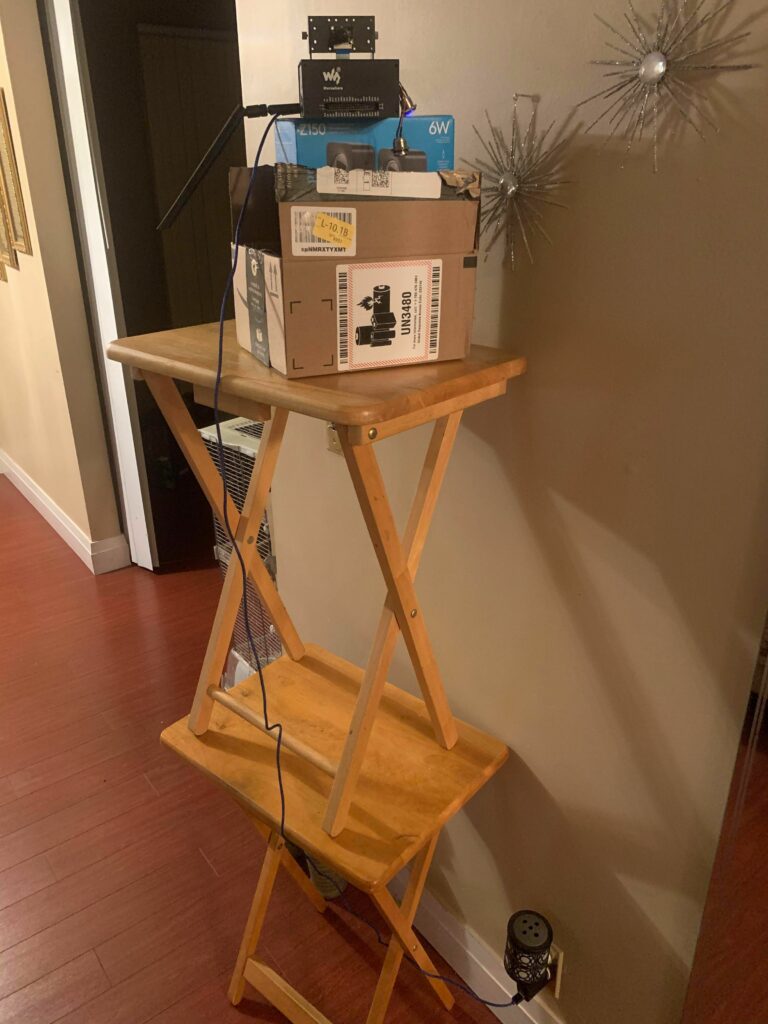
The Computer Vision Testing Setup 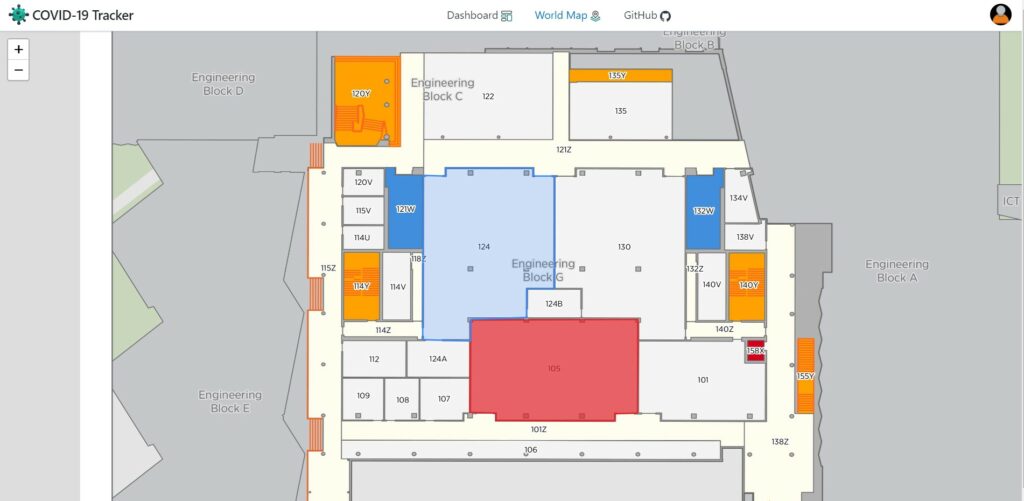
Local map showing a drawn room polygon 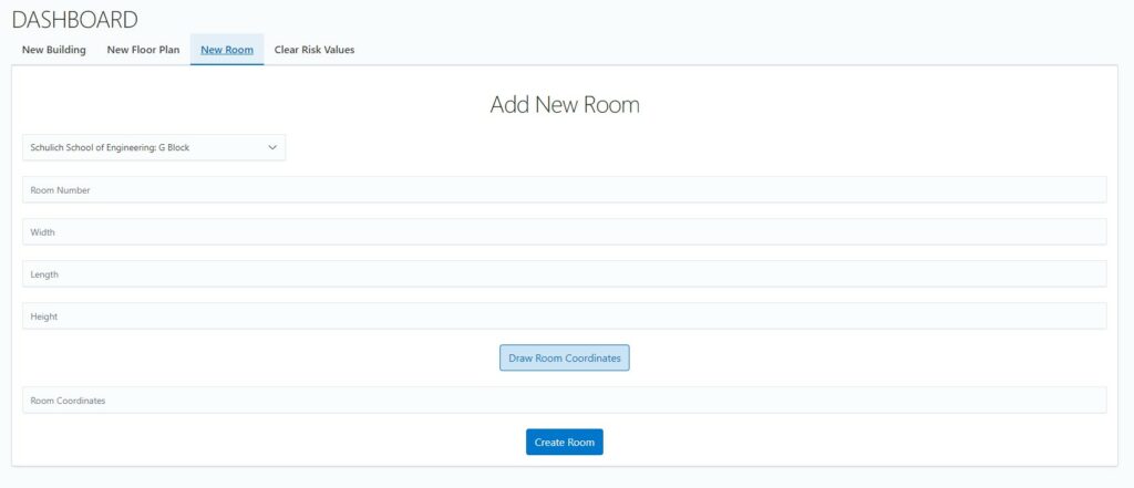
User dashboard 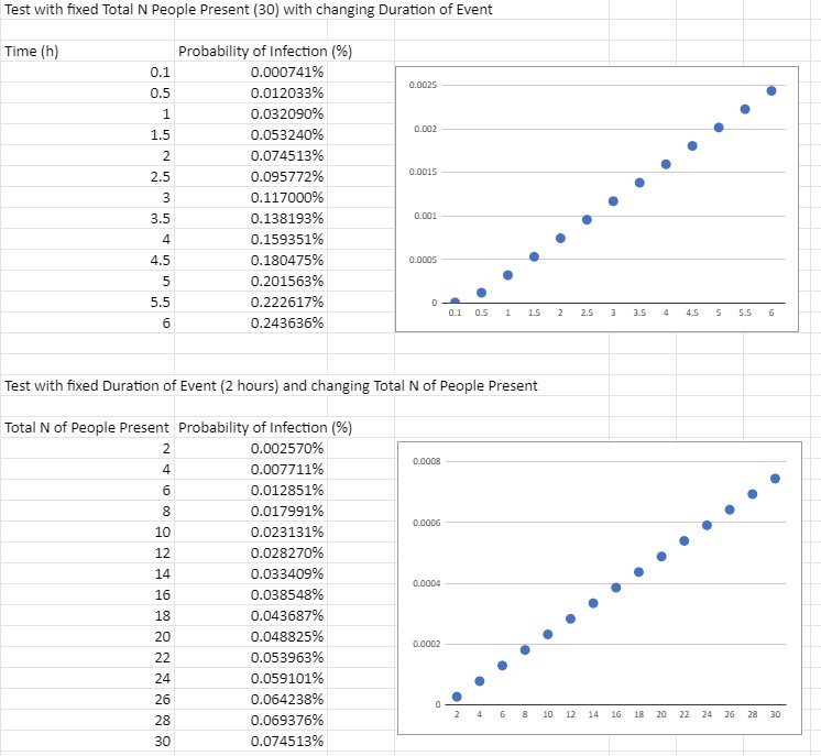
Sample outputs from the implemented math model prototype 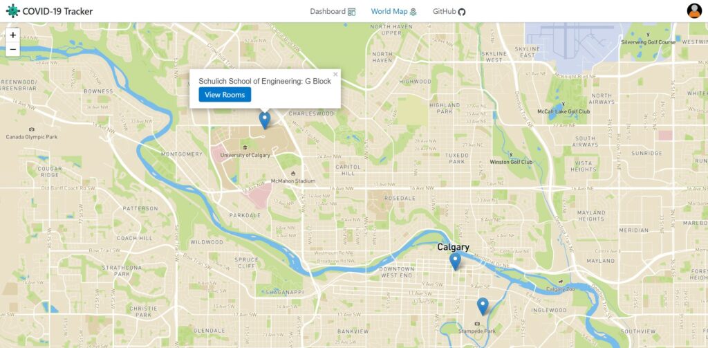
Global Map showing “buildings” with the system enabled 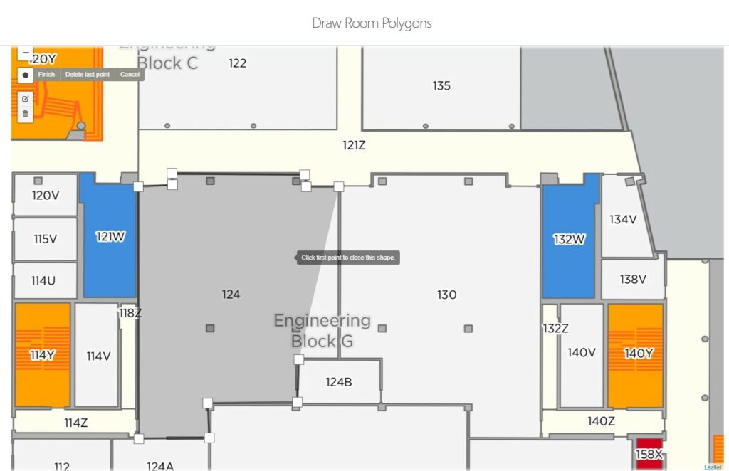
Drawing a new room polygon 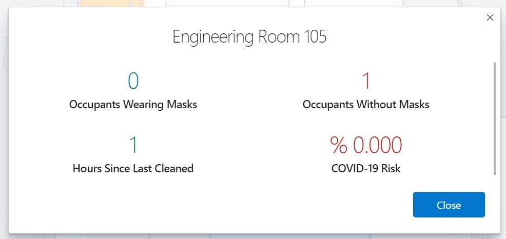
COVID-19 Risk info shown in a popup window
