Project Category: Geomatics
Join our presentation
Please join our presentation on April 5, 2022 from 9:30 am to 1:30 pm MDT
Meeting ID: 926 6686 4526
Passcode: y5vx2u
About our project
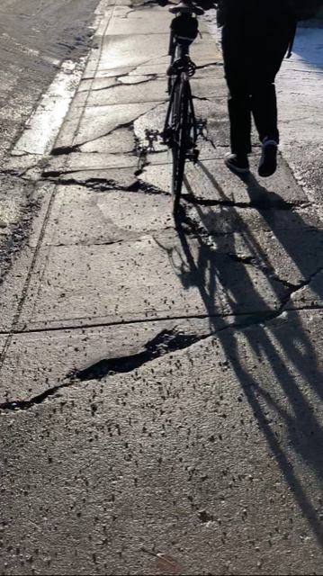
Safe, accessible, and well-maintained sidewalks are fundamental for any municipality. Our team has developed potentially different methods for collecting detailed information and assessing sidewalk conditions in a consistent and repeatable way. The most common method of sidewalk assessment is visual inspection and can be subject to the observer’s experience and practical knowledge. Through our project, we were able to collect data using different methods, such as visual inspection, convolution neural network (CNN), and static 3D laser scan, to analyze which method is the most efficient for prioritizing areas for sidewalk repair.

Meet our team members

Alex Torres
I am a fourth-year Geomatics Engineering student at the University of Calgary. I’m an international student from Mexico. During my internship, I had the opportunity to work as a mine surveyor in Northern Alberta and I will be working this summer as a survey assistant to learn more about legal and construction survey. I hope to pursue a career as a land surveyor and get involved in community development and non-profits. Outside school I like to spend time doing sports and cooking.
Jocelyn Lawless
I am completing my final year of my undergraduate degree in Geomatics Engineering, specializing in cadastral surveying. During my work co-ops, I gained experience as a survey assistant working on pipeline construction, legal surveys, pile layouts, as-builts, topographic surveys, pipeline integrity, and other various jobs in Alberta, Saskatchewan, and British Columbia. After graduation, I hope to pursue a career as a professional land surveyor. When I am not working, I enjoy spending time outside in the mountains, reading, and travelling.

Jad Shehadeh
I am a fourth-year Geomatics Engineering student, and I am set to graduate in the Spring of 2022. Having gone through four years of engineering, I found that I am very interested in the Geospatial aspect of Geomatics Engineering, and hope on furthering my knowledge on that field post graduation.

Yon Gill Yu
I am a fourth-year Geomatics Engineering student at the University of Calgary. I am an international student and was born and raised in Kazakhstan. I began my engineering journey in Fall 2018. Right after high school completion, I decided to move to Calgary and picked Geomatics Engineering discipline for myself due to my passion for an information technology discipline.
Details about our design
HOW OUR DESIGN ADDRESSES PRACTICAL ISSUES
With limited budget and resources, sidewalks are often overlooked. Damaged or unmaintained sidewalks may compromise a pedestrian’s safety and the accessibility of using public spaces. The importance of a well-maintained sidewalk network can affect many areas of the community, such as safety, the economy, socialization, and the environment. By addressing these issues, a municipality can avoid injury liabilities and encourage healthy lifestyles and social interactions by providing a sidewalk network that is accessible and free of tripping hazards and uneven surfaces.
WHAT MAKES OUR DESIGN INNOVATIVE
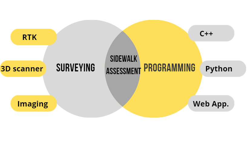
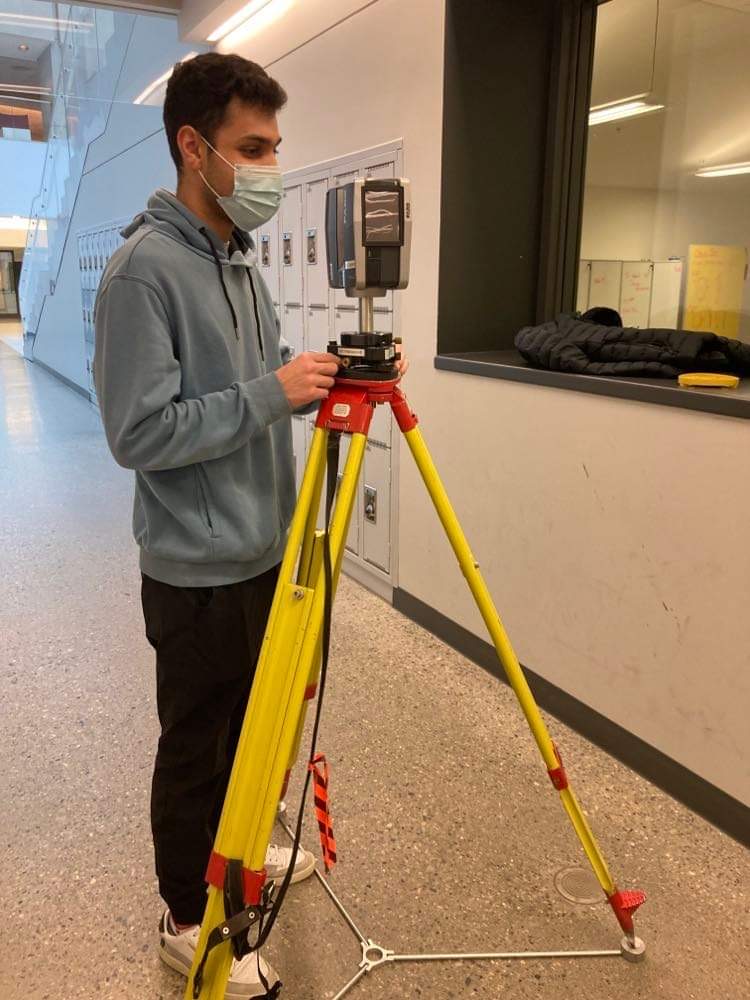
Two of the most important aspects of geomatics engineering are fusion of sensor data and software analysis in the spatial domain. In this project, we took both of these areas and created two different solutions. The first solution is a 3D laser scanning assessment which utilizes the land surveying side of geomatics. The second solution uses machine learning to create a convolutional neural network which makes use of the programming and software development side of geomatics.
WHAT MAKES OUR DESIGN SOLUTION EFFECTIVE
The most common method for assessing sidewalk maintenance conditions is a visual inspection. Although efficient in smaller municipalities, a visual inspection can be harder to implement in larger cities. Experience and a practical understanding of how sidewalk conditions can change over time are necessary for a reliable assessment. By testing multiple collection methods, our solution will provide detailed information about sidewalk condition that has a qualitative assessment for prioritizing sidewalk repair and a visual presentation of our results collected in the field. The development of our design should be feasible, efficient, mobile, and automated to take the guesswork out of condition assessment.
HOW WE VALIDATED OUR DESIGN SOLUTION
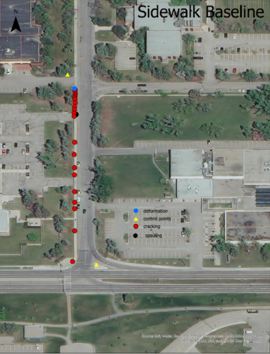
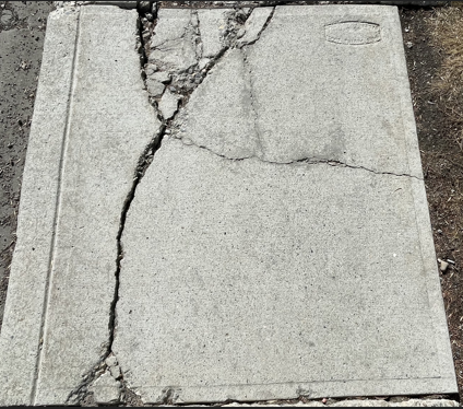
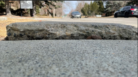
Each solution was compared to a baseline, which was our visual inspection. The team focused on the condition criteria from the baseline, which accounted for four defects; Deflection, Cracking, Spalling, and Settlement. These conditions were quantified from the results of each method and compared.


FEASIBILITY OF OUR DESIGN SOLUTION
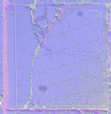
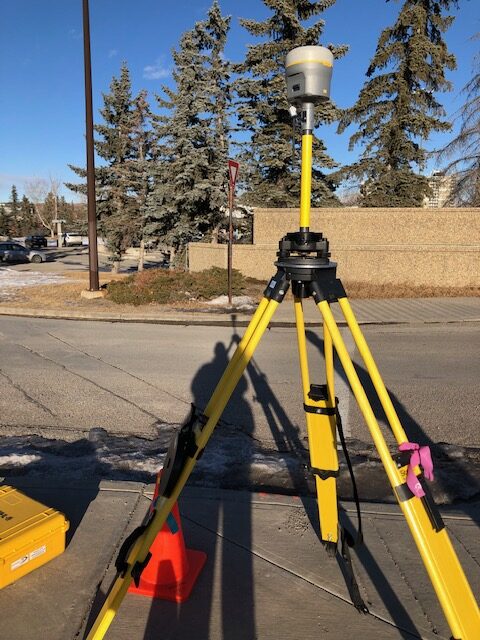
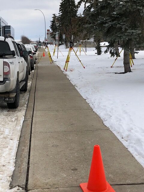
Each development method of data collection, CNN and 3D scanning, had pros and cons. The 3D scanning and modeling provided high resolution, measurable, and visual results, but was time consuming and would be better implemented with a dynamic setup with GPS, instead of multiple static setups. The Faro Scene software used to process the 3D data was very user friendly with automated registration and it was easy to combine the multiple scan frames. Although, there were data gaps directly underneath the instrument. The CNN method still required more development as it proved to be very complicated to create the machine learning algorithms. Our team was able to collect data for the recognition of cracks in the app quickly and the overall cost of the CNN implementation compared to the laser scanning was significantly less. Overall, each method could be used as an alternative to a visual inspection depending on the clients requirements.
Partners and mentors
We would like to thank our advisor Rob Radovanovic for his support and patience in guiding us through this project. Rob was a great resource for information, kept us on schedule, and we could not have completed this project without him.
We would also like to thank Rene Manzalo Islas for his encouragement with the CNN implementation, Christian Bernal for helping us with the app development, Enis Alushi for helping us collect data for our database, Farid Hode for his assistance with Python and GitHub, Kathleen Chow, and the Geomatics survey stores for always being available and providing the equipment we required for our field work.
Lastly, we would like to thank our friends, professors, instructors, and teaching assistants, in the department for we could not have gotten this far without each other.


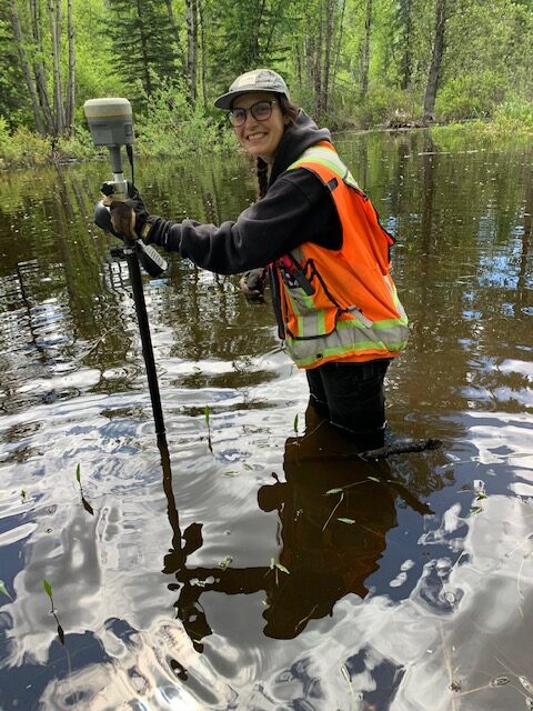
Our photo gallery

References
- A. Sullo, Sidewalk rating sheet, private communication, Oct. 2021.
- Faro Authorized Instructor Scan Training, https://www.scan-training.com/?fbclid=IwAR3Q_1PjOx2ISfp4EvcO9gznIcEEpShX54SnRbK3dbSRO3nRGkreAi28VqI
- Roboflow computer vision training, https://roboflow.com/?fbclid=IwAR0L_rs3GNnSB-lsfTATi-uMHCcaEzsQaQae-wXgJQf2E0j6yEQqt8G7_fs
- D. Schick and B. Newstead, Case Study, Research and Implementation of a GIS-Based Sidewalk Assessment System. St.Albert, 2019.
- GitHub, https://github.com/ultralytics/yolov5?fbclid=IwAR3ZOgljd05EE6HPPzHj70lHFx03svIMiC03tDmwZZevKSPHATnVOlOr_Do
