Project Category: Geomatics
Join our presentation
About our project
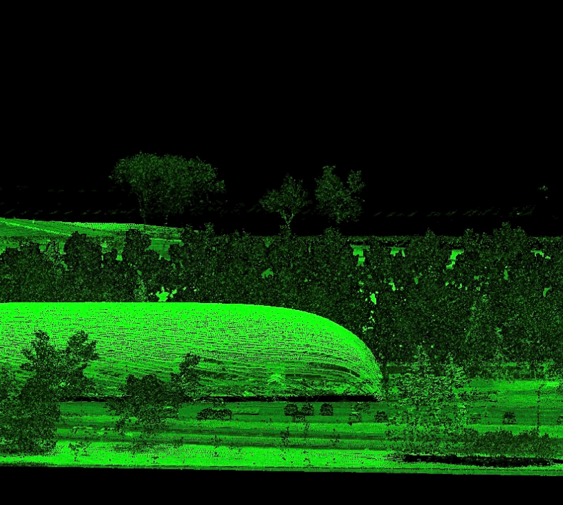
Our 2022 Capstone Design Project was to create a true orthophoto of the University of Calgary. An orthophoto is an image from an aerial perspective of an area of interest. The image has been orthorectified (geometrically corrected) so that the image scale is uniform across. They are adjusted to remove distortion that results from the aerial camera’s lens and the angle that the photos are taken at. The photos are also georeferenced to the Earth.
The first step for the team was a ground control survey of the campus. With known points within the area of interest, the team can correct the orientation and position of the images using aerial triangulation. To properly represent the terrain and buildings on campus, a digital surface model was created using the given Lidar data. The given aerial images cover the entire area of interest, but must be mosaiced together (like a puzzle) so that it aligns all the images in a way that accurately represents the campus. All this work combined creates a digital image that represents the University’s campus from the perspective of a “perfect” overhead view.
“You will always have to compromise something with a “true” orthophoto. Not everything can be perfect. What you choose to perfect depends on your application purposes.”
Meet our team members
George Lin
(Technical Lead)
George aims to work in the GIS realm of geomatics and hopes to become a geospatial specialist. A fun fact about him is that he’s been told he sounds British even though he’s never been to England.
Shaaden Salem
(Project Manager and Presentations Lead)
Shaaden has been a Geomatics Intern at Airborne Sensing Corp. and a Surveying Assistant at Benchmark Geomatics. She is joining the Monitoring, Tunneling, and Mining team at Trimble after graduating. She loves exploring nature and connecting with people through art in its different forms.
Nick Noll
(Technical Lead)
Nick was previously a Geomatics Intern at OGL Engineering and plans to work at Trimble after graduating. He likes to play instruments and enjoys the outdoors in his free time.

Andrew Gruber
(Writing Lead)
Andrew plans to be a Field Operator for LIDAR Mapping Services after graduating. He loves basketball and all things fitness related. A fun fact about him is that he has seen all 3 spy kids movies twice as an adult.
Details about our design
WHAT IS THE PRACTICAL USE OF AN ORTHOPHOTO?
Being that an orthophoto is a fully corrected image, which means you can use it for a map. Essentially, anything you can use a map for, you can use an orthophoto as well. This is a large variety of potential applications. Municipal and state governments may use them as basemaps. Engineering companies may use them for project planning pipeline installation. It may even be used for city planning. Essentially, as with a map, it has a huge variation of engineering or non engineering projects. Now you may be thinking, why not use a traditional vector map? The orthophoto holds a few distinct advantages. For many areas, an orthophoto can be cheaper to produce than a traditional vector map and is also generally more encompassing in terms of what is presented in the photo. Additionally, it is useful for verifying vector datasets as it is geometrically accurate to the actual earth.
HOW WE VALIDATED OUR DESIGN SOLUTION
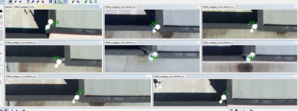
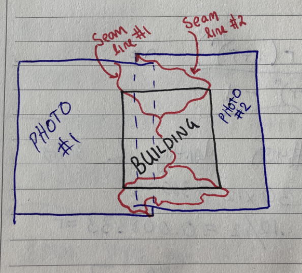
An orthophoto is the culmination of a lot of consecutive work that is eventually combined to create the desired digital image. Much of the work is dependent on the quality of the previous task package. Therefore, it is important to guarantee precision periodically throughout the design process. The first step was surveying ground control. The quality of the ground control was validated by comparing surveyed Alberta Survey Control Monument coordinates to their published ones. This precision would be propagated throughout the work, so it was important to ensure the ground control was accurate. The quality of the aerial triangulation could be confirmed more easily, through visual point checks and root mean square values. The quality of the final mosaic was assessed with a simple visual check, looking for misaligned seams or distortion in the image. Finally, the final orthophoto accuracy was validated by manually measuring the ground control in GlobalMapper and comparing it against the values from our survey, which have a known precision.
FEASIBILITY OF OUR DESIGN SOLUTION
In terms of cost, the team was able to achieve a final product without spending a single dollar. The equipment for the ground control survey was all rented courtesy of the survey store on campus. A variety of software were used during the process, but all were accessible through remote access to OGL’s computers, giving the team free access to a variety of excellent photogrammetry software packages. The team did encounter a variety of challenges ranging from licensing issues to software crashing, but were able to overcome these obstacles with the help of advisors at OGL. Additional required software that could not be accessed through OGL were accessed using campus computers. The work itself was very challenging, and the team had to dedicate hundreds of combined hours in order to achieve a satisfactory final orthophoto. However, much of this time can be attributed to learning the ropes and gaining experience in all the work that goes into creating a true orthophoto, as many aspects of the design were unfamiliar to the team.
WHAT COULD HAVE BEEN DONE DIFFERENTLY OR BETTER?
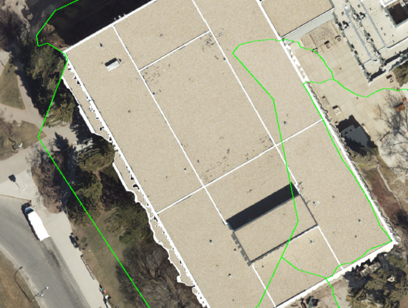
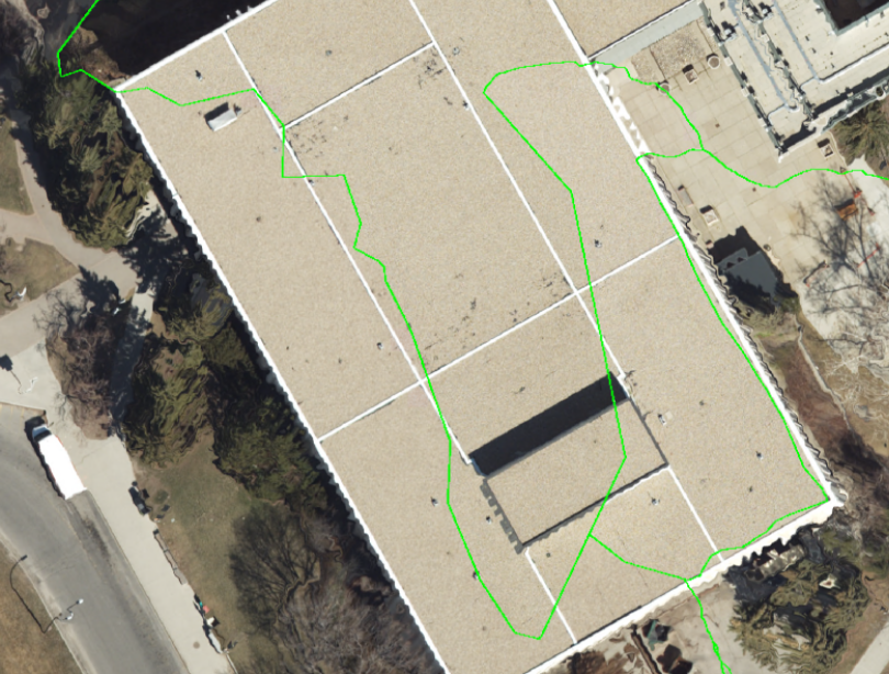
With a young team working on a project of this scale, much of the process is a learning experience as you go. There are always design choices that could be improved or modified to achieve an even better final product. Upon reflection, the team decided there were a few ways we could have gotten an even better orthophoto. The first would be a more dedicated ground control point survey. With longer setups times for a static survey, the accuracy of the ground control would have improved. This would have propagated the accuracy throughout the work, improving the accuracy of the final orthophoto. Additionally, the quality of the photo could have been enhanced by upgrading from just the digital surface model that was utilized. If the team could get access to building models for the campus and combine these with a digital elevation model, orthophoto distortion on the buildings could have been avoided.
Partners and mentors
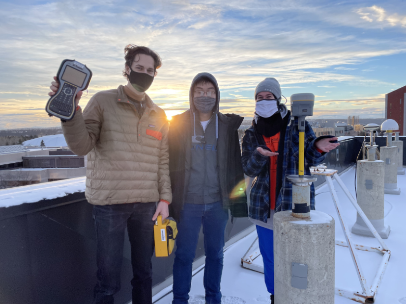
A big shout out goes to Sam Rondeel. Sam Rondeel is our OGL client representative but also our main advisor and mentor! We also want to thank the UofC Geomatics Survey Store for helping us out with coordinating our ground control survey equipment rentals and roof access. And many thanks to all the professors, TAs and peers who provided guidance and information to the team along the way.
Our photo gallery
References
- “Ground control points: why are they important?,” Pix4D. https://www.pix4d.com/blog/why-ground-control-points-important (accessed Mar. 27, 2022).
- R. A. Fowler, “CONCEPTS AND APPLICATIONS OF DIGITAL ORTHOPHOTOS,” p. 7. (accessed Mar. 27, 2022).
- G. Portillo, “Orthophoto: what it is, characteristics and what it is for,” Meteorología en Red, Nov. 11, 2020. https://www.meteorologiaenred.com/en/Orthophoto.html (accessed Mar. 27, 2022).
- R. B. Southard, “Orthophotography — Its Techniques and Applications,” p. 9. (accessed Mar. 28, 2022).
